Know Before You Go
When to Go
This route is recommended between mid-June through September. Heavy spring snow or early fall snow could shorten this window. You can check current snow depth at various high points near the route using the Snow Depth Map. To see snow depth, click a location on the map and then open the ‘Parameters’ section.
Unfortunately, wildfires are having an increasing impact on bikepacking in the West. For details about current wildfires in Colorado, see InciWeb Colorado.
Recommended Itinerary
We first rode the entire loop in August of 2024 using an 11-day itinerary that included a wonderful half-day off in Hot Sulfur Springs. This itinerary had a great cadence. We started riding each day just after 8:00 am and rode most of the day with time to take in the scenery and stop for meals. Every day included the opportunity to eat in a restaurant at some point during the day, and we usually did. We finished the route strong and happy.
You can see the details of our itinerary here.
Recommended Bike & Gear Setup
Personal preference will play a key role in deciding what bike to take, and as they say, the best bike is the one you own.
For the most fun and all-round comfort on both the gravel roads and singletrack, we recommend a light, hardtail mountain bike with 2.2 - 2.4 inch tires, with a suspension fork.
Gravel bikes are also appropriate for this route if they have low gears, and if the rider has experience riding technical singletrack or is willing to bypass the singletrack by riding pavement.
This route has a significant amount of climbing at altitude so keeping your camping setup as light as possible is recommended.
Resupply
Surface water is abundant along the route, and purified water is available in towns. Treat or filter all surface water. Carrying 3L of water on the bike plus an empty 2L reservoir for longer stretches or dry camping is recommended. If in doubt, carry more.
| Route Mile | Since Last | Name | Services |
|---|---|---|---|
| 4.3 | 4.3 | Masonville | CS |
| 49.0 | 44.7 | Glen Echo | CS, R, Camp |
| 58.8 | 9.8 | Red Feather Lakes | R, CS off route |
| 128.6 | 69.8 | Walden | CS, R, C, L |
| 178.0 | 49.4 | Steamboat Springs | CS, G, C, L, B |
| 254.1 | 76.1 | Kremmling | CS, G, C, L |
| 279.5 | 25.4 | Hot Sulfur Springs | CS, C, R |
| 307.4 | 27.9 | Fraser/Winter Park | CS, G, C, L, B |
| 349.0 | 41.6 | Rollinsville | R |
| 353.2 | 4.2 | Nederland | CS, G, C, L, B |
| 389.9 | 36.7 | Ferncliff | CS |
| 390.6 | 0.7 | Allenspark | R |
| 410.8 | 20.2 | Estes Park | CS, G, C, L, B |
| 418.7 | 7.9 | Glen Haven | CS |
| 433.9 | 15.2 | The Dam Store | CS |
| 440.4 | 6.5 | Masonville | CS |
Key: CS = Convenience Store, R = Restaurant, C = Camping, L = Lodging, G = Grocery Store, B = Bike Shop
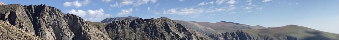
Mountain Safety
Hypothermia is a significant danger in the Colorado high country, even in the summer. Fast-developing thunderstorms can drop a deluge of near-freezing rain quickly, sapping precious body heat from even a well-prepared bikepacker. Be prepared to throw on rain gear with insulating layers underneath, and consider bringing an umbrella that can be used to shelter in place during short and severe storms.
Temperatures can drop to near freezing overnight in the high country. Be prepared for this with the combination of an appropriate sleeping bag and additional layers of clothing. A 32-degree sleeping bag should work well and you can wear additional clothes at night if needed.
Lightning is also dangerous in the Colorado high country, especially above the treeline. If approaching the treeline when a storm is imminent, consider staying below the treeline until the storm passes.
Leave No Trace
See Care for Colorado Leave No Trace Principles.
Be especially careful with fire, and avoid building new fire rings. Don’t build fires on beds of pine needles as fire can burn down and spread underground.
If burying your human waste, please go the extra mile (or 100 yards) and find a very remote spot away from roads and trails to do your business.
Land Ownership
The route will pass through National Forest land, Colorado State-owned land, and private land.
Dispersed camping is generally allowed in National Forests with some exceptions such as near trailheads, campgrounds, and picnic areas. If possible, make yourself invisible when wild camping. See Arapaho & Roosevelt National Forests – Dispersed Camping.
Colorado State lands are mostly reserved for hunting and often require a hunting permit to camp. The one obvious state land area is when climbing over to Hot Sulfur Springs from the Colorado River. The State of Colorado Property Viewer does a good job of showing national forest and state land boundaries.
Travel Logistics
If flying into DIA, you can catch a shuttle to Fort Collins with Groome Transportation. You can book online and specify that you are bringing a bicycle for a small fee. If staying at a hotel before and after the ride, you may be able to get the hotel to store your bike box for the duration of the ride.
If driving to Fort Collins and parking a vehicle, you have several options:
- The Fort Collins Hilton has a paid parking lot. As of Feb 2024, they allowed cars to be parked for $15/day. Call and confirm before arriving.
- The Fort Collins downtown parking garages use ParkMobile to manage payments with kiosks on site. The kiosk allows the purchase of up to 30 days of parking.
- Take your chance parking on the street somewhere.